
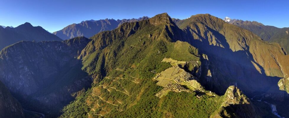
10 Lost Cities That Were Rediscovered After Centuries

In 1911, a Yale lecturer climbed a steep ridge in Peru and found farmers already working the terraces of an Inca citadel. That’s the awkward truth behind most “lost cities.” Somebody nearby usually knew exactly where they were. What got lost was the wider world’s memory, along with the names, the history, and sometimes the very idea that such a place had existed.
So this list of 10 lost cities rediscovered after centuries comes with a footnote. These cities fell off the maps of empires, scholars, and outsiders, not always off the maps of the people living beside them. From a Bronze Age capital in Turkey to a terraced jungle city in Colombia, here’s how each one faded and how it came back.
10Hattusa, Turkey
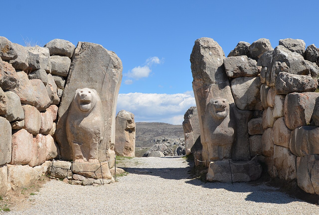
Around 1700 BC, a king named Anitta burned a city in central Anatolia and left an inscription calling down the Storm God on any future king who dared to resettle it. Within a century or so, the Hittites did exactly that, and Hattusa became the capital of one of the great powers of the Bronze Age, a rival to Egypt itself.
At its peak, the city covered about 1.8 square kilometers behind more than 6 kilometers of walls, entered through monumental gates guarded by carved lions and sphinxes. Then, around 1200 BC, amid the wider collapse of Bronze Age kingdoms, Hattusa was abandoned and burned, probably after the royal court had already left. The Hittites slipped from memory so completely that, for centuries, Western scholars knew them mainly from passing mentions in the Bible.
In 1834, French traveler Charles Texier came across vast ruins near the village of Boğazköy, though nobody yet knew what they were. The answer came in clay. Excavations led by Hugo Winckler from 1906 uncovered royal archives whose texts identified the site as Hattusa, and some 30,000 tablets have been recovered over the years. Today the ruins near modern Boğazkale form a UNESCO World Heritage Site, a few hours’ drive east of Ankara.
9Ciudad Perdida (Teyuna), Colombia
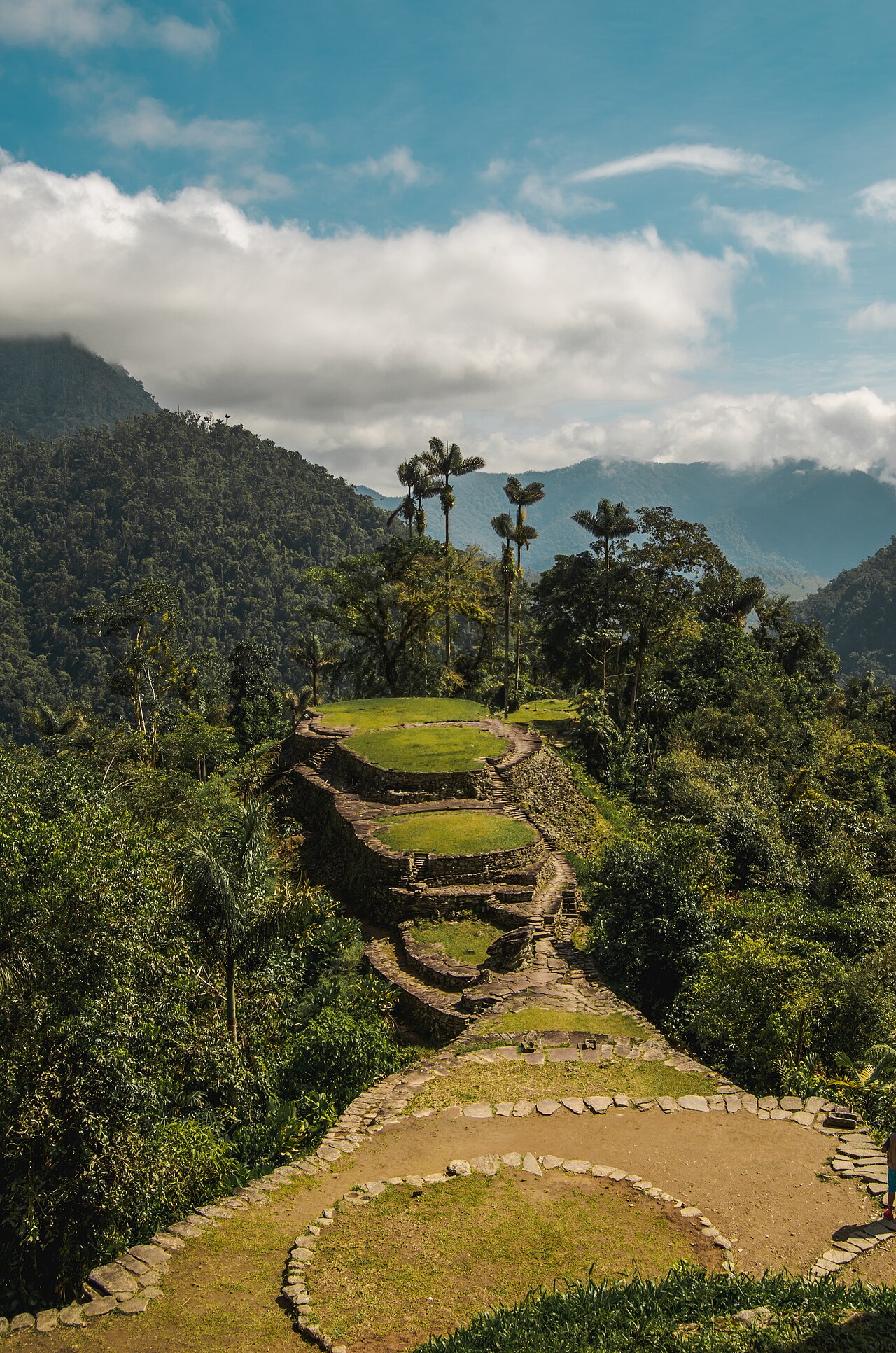
Reaching Colombia’s Ciudad Perdida means days of hiking through jungle, wading across rivers, and finally climbing roughly 1,200 moss-slick stone steps. At the top, grassy circular terraces spill along a ridge in the Sierra Nevada de Santa Marta like a staircase built for giants.
The city, called Teyuna by the Indigenous peoples of the Sierra, is believed to have been founded around AD 800, roughly 650 years before Machu Picchu. It was a major center of the Tayrona culture, with around 170 terraces that once supported houses, plazas, and ceremonial spaces, all linked by paved paths and stairways. After the Spanish conquest, Tayrona communities were devastated by war and disease, and the forest slowly reclaimed the city.
The outside world learned of it in 1972, when a family of treasure looters stumbled onto its stone steps, reportedly while chasing a game bird that had fallen. Looting spread fast, and Colombian archaeologists arrived in 1976 to protect and restore the site. For the Kogi, Arhuaco, Wiwa, and Kankuamo peoples, though, Teyuna was never lost, and it remains a sacred place. Today you can visit only with licensed guides on a multi-day trek, typically four or five days round trip, starting near Santa Marta.
8Mohenjo-daro, Pakistan
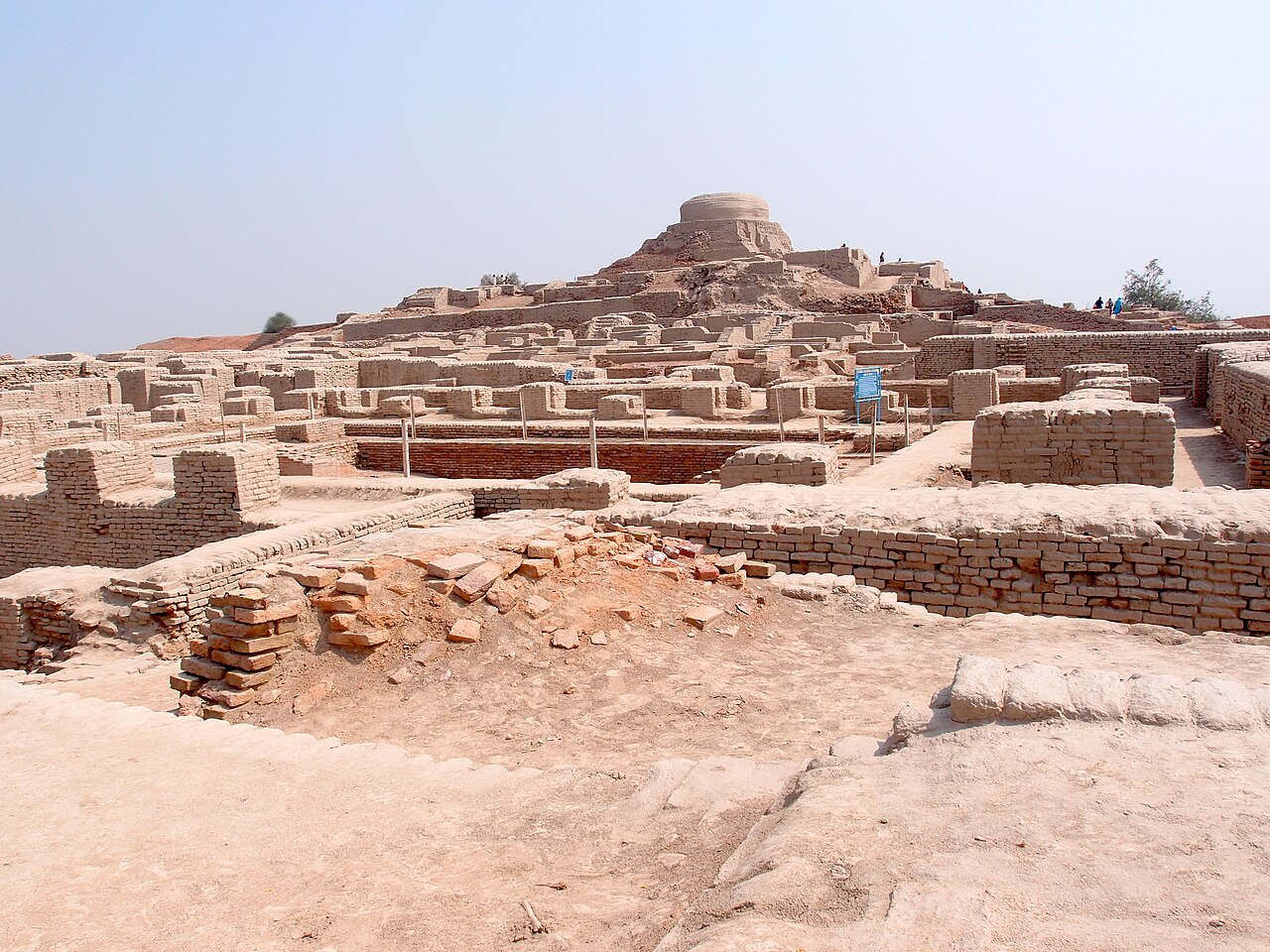
About 4,500 years ago, the people of Mohenjo-daro had covered drains running beside their streets. The city on the Indus River was laid out on a grid, built from standardized baked bricks, and dotted with hundreds of wells, a level of planning that still impresses modern urban engineers.
Built around 2500 BC, it was one of the largest cities of the Indus Valley Civilization, home to perhaps 40,000 people. Its most famous structure, the Great Bath, is a watertight pool about 12 meters long, sealed with bitumen and possibly used for ritual bathing. Then, around 1700 BC, the city was abandoned as the wider civilization declined, for reasons historians still debate, from shifting rivers to changes in climate and trade.
Locals knew the great mound well, and its Sindhi name is usually translated as “Mound of the Dead.” Its true age, though, was a mystery. In 1919 and 1920, R. D. Banerji of the Archaeological Survey of India investigated the site, which was crowned by a much later Buddhist stupa, and found far older remains underneath. In 1924, John Marshall announced that an entire forgotten civilization had come to light. Its script, found on small carved seals, still hasn’t been deciphered.
7Great Zimbabwe, Zimbabwe
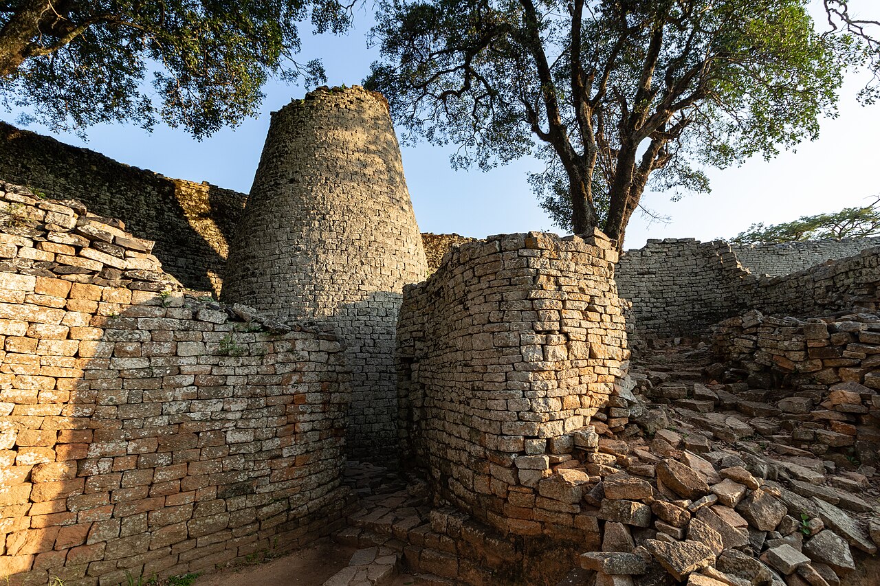
The Great Enclosure at Great Zimbabwe is a masterpiece of patience: curving granite walls up to about 11 meters high and roughly 250 meters long, built from carefully shaped blocks fitted together without any mortar. Inside stands a mysterious solid stone tower about 9 meters tall whose purpose is still debated.
The city was the capital of a powerful kingdom built by ancestors of the Shona people, with most of its stone construction dating from the 11th to the 15th centuries. It grew wealthy on trade in gold and ivory that connected the African interior to the Indian Ocean, and excavations have turned up glass beads and Chinese porcelain from distant ports. By the 16th century the city was in decline. Its name is usually translated from Shona as “houses of stone.”
When German explorer Carl Mauch reached the ruins in 1871, he refused to believe Africans had built them, crediting outsiders and linking the site to the Queen of Sheba. Archaeologist David Randall-MacIver showed its African origins in 1905, yet Rhodesia’s white-minority government pressured researchers to downplay that conclusion into the 1970s. When the country won independence in 1980, it took its name from the ruins: Zimbabwe.
6Tikal, Guatemala
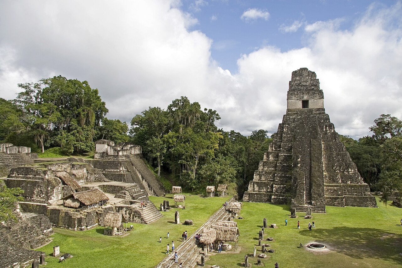
Climb to the top of Temple IV at Tikal at dawn and you’ll understand why the Maya built so high. From about 70 meters up, the roof combs of other pyramids poke through an ocean of rainforest canopy while howler monkeys roar somewhere below. For much of the first millennium AD, this was one of the most powerful cities in the Maya world.
Known to its rulers by a name read as Mutal, Tikal peaked between roughly AD 200 and 900, with population estimates ranging from about 10,000 to as many as 90,000. Its history reads like a political thriller. In January 378, inscriptions record the arrival of a warrior named Siyaj K’ak’, linked to the distant metropolis of Teotihuacan, at almost the same moment the reigning king died. A new, foreign-backed dynasty followed. By the end of the 10th century, though, the city had been abandoned.
Word of ruins deep in the forest had long circulated in the Petén, but the first official expedition came in 1848, led by regional officials Modesto Méndez and Ambrosio Tut, with artist Eusebio Lara sketching what they found. Today Tikal National Park protects about 570 square kilometers of forest and ruins and has been a UNESCO World Heritage Site since 1979. Stay overnight nearby to catch the temples at sunrise.
5Troy, Turkey
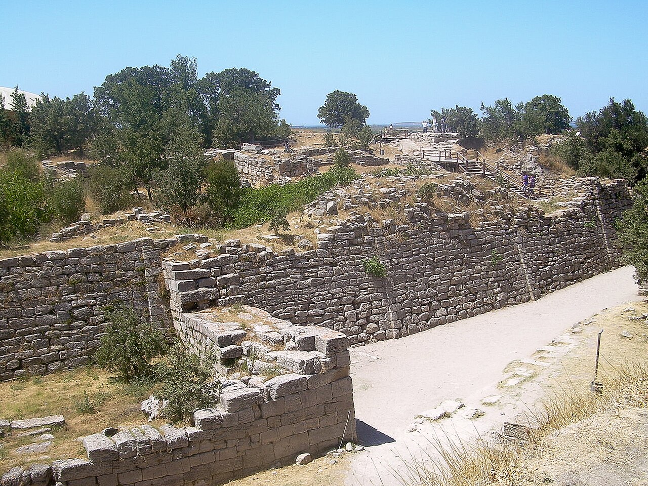
For centuries, plenty of scholars assumed Troy was as mythical as the wooden horse. Homer’s Iliad described a 10-year siege of a rich city on the coast of Asia Minor, but where was it, and had it ever really existed?
The answer lay in a mound called Hisarlık in northwest Turkey. Frank Calvert, a British expatriate who owned part of the site, dug test trenches in the 1860s and became convinced this was Troy. Then Heinrich Schliemann, a wealthy German businessman, arrived and from 1870 carved a huge trench through the mound. In 1873 he unearthed a hoard of gold and silver he called “Priam’s Treasure,” though it turned out to be more than a thousand years too old for any Trojan War. His haste also destroyed layers that later archaeologists would dearly love to have studied.
Today we know Hisarlık holds nine main cities stacked on top of one another, from the early Bronze Age into Roman times. Troy VI and VIIa, destroyed around 1300 and 1180 BC, are the leading candidates for Homer’s city, and Hittite texts mention a western kingdom called Wilusa that many scholars link to Ilios. Whether the Trojan War happened as Homer told it, historians still argue. The site has been UNESCO-listed since 1998.
4Angkor, Cambodia
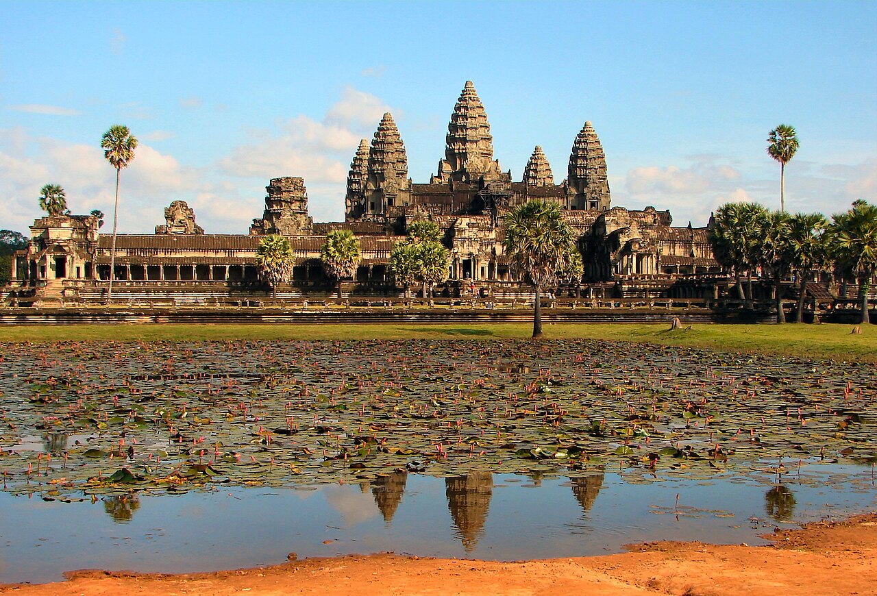
Angkor Wat’s towers are so iconic they appear on Cambodia’s national flag, and the temple itself, built in the first half of the 12th century for King Suryavarman II, is widely considered the largest religious monument on Earth. Yet it’s only one piece of something much bigger.
Angkor was the heart of the Khmer Empire, which dominated much of mainland Southeast Asia from roughly the 9th to the 15th centuries. Beyond the stone temples lay a sprawling city of wooden houses, canals, and enormous reservoirs. Airborne laser scans (LiDAR) carried out since 2012 have mapped street grids and waterworks hidden beneath the forest, showing that Greater Angkor ranked among the largest urban complexes of the preindustrial world. After the Khmer capital shifted south in the 15th century, much of the city faded into jungle.
Angkor was never lost to Cambodians, though. Buddhist monks kept Angkor Wat in use for centuries, and a Portuguese friar visited in the 1580s. What changed was Western attention. French naturalist Henri Mouhot’s vivid notes from his 1860 visit, published after his death, turned Angkor into a sensation in Europe. Today the archaeological park near Siem Reap is a UNESCO site; buy a multi-day pass, start before sunrise, and save root-wrapped Ta Prohm for when you can linger.
3Petra, Jordan
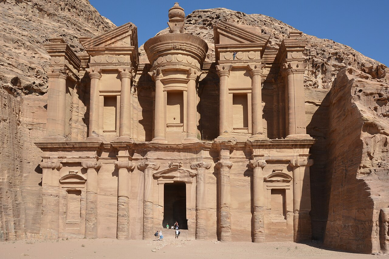
The Siq, the narrow gorge that leads into Petra, twists for more than a kilometer between sandstone walls that in places stand only a few meters apart. Then it opens, and there’s the Treasury: a two-story facade about 37 meters tall, carved straight into a rose-colored cliff.
Petra was the capital of the Nabataeans, Arab traders who grew rich on caravans of incense and spices and engineered dams, cisterns, and channels to thrive in the desert. The Treasury, or Al-Khazneh, was likely carved in the 1st century AD, possibly as a royal tomb. Local legend held that pirate gold was hidden in the stone urn at the top, and bullet marks show people tried to shoot it loose. Rome annexed the kingdom in AD 106, a devastating earthquake in 363 wrecked buildings and waterworks, and as trade routes shifted, the city slowly emptied.
The local Bedouin, the Bdul, lived among the tombs and caves for generations, until most were resettled nearby in the 1980s. Petra was “lost” only to Europe until 1812, when Swiss traveler Johann Ludwig Burckhardt, traveling in disguise as “Sheikh Ibrahim,” talked a guide into leading him through on the pretext of sacrificing a goat at the nearby tomb of Aaron. Go early, wear sturdy shoes, and save energy for the roughly 800 steps up to the Monastery.
2Pompeii, Italy
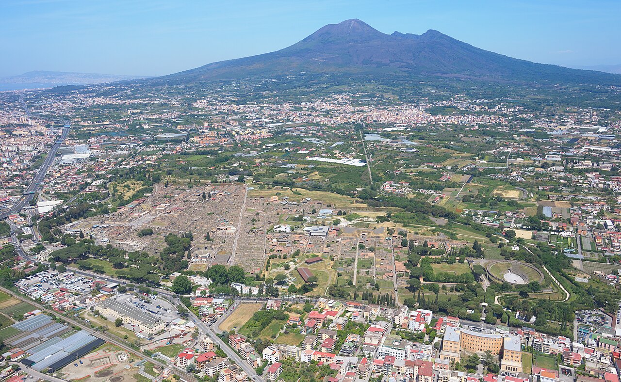
Pompeii’s walls still carry election slogans, jokes, and shop ads painted nearly 2,000 years ago. When Mount Vesuvius erupted in AD 79, it buried this busy Roman town of perhaps 10,000 to 20,000 people beneath meters of ash and pumice, sealing bakeries, bars, and bedrooms like a time capsule.
The name survived in Roman writings, but the city’s exact location slipped away. In the 1590s, architect Domenico Fontana dug a water channel straight through the buried town, hitting painted walls and inscriptions without realizing what they were. Formal excavations began in 1748, and an inscription found in 1763 finally confirmed the city’s identity. In 1863, Giuseppe Fiorelli realized that hollows in the hardened ash had been left by bodies and filled them with plaster, creating casts that still preserve the final postures of the eruption’s victims.
The digging hasn’t stopped. Roughly two-thirds of the city has been uncovered, and new finds keep making headlines, including richly frescoed rooms revealed in 2024. Even the eruption’s date is being revisited, since a charcoal inscription found in 2018 points to an autumn eruption rather than the traditional August date. Pompeii draws around 2.5 million visitors a year, and a daily cap of 20,000 tickets was introduced in 2024, so book a timed entry and start early.
1Machu Picchu, Peru
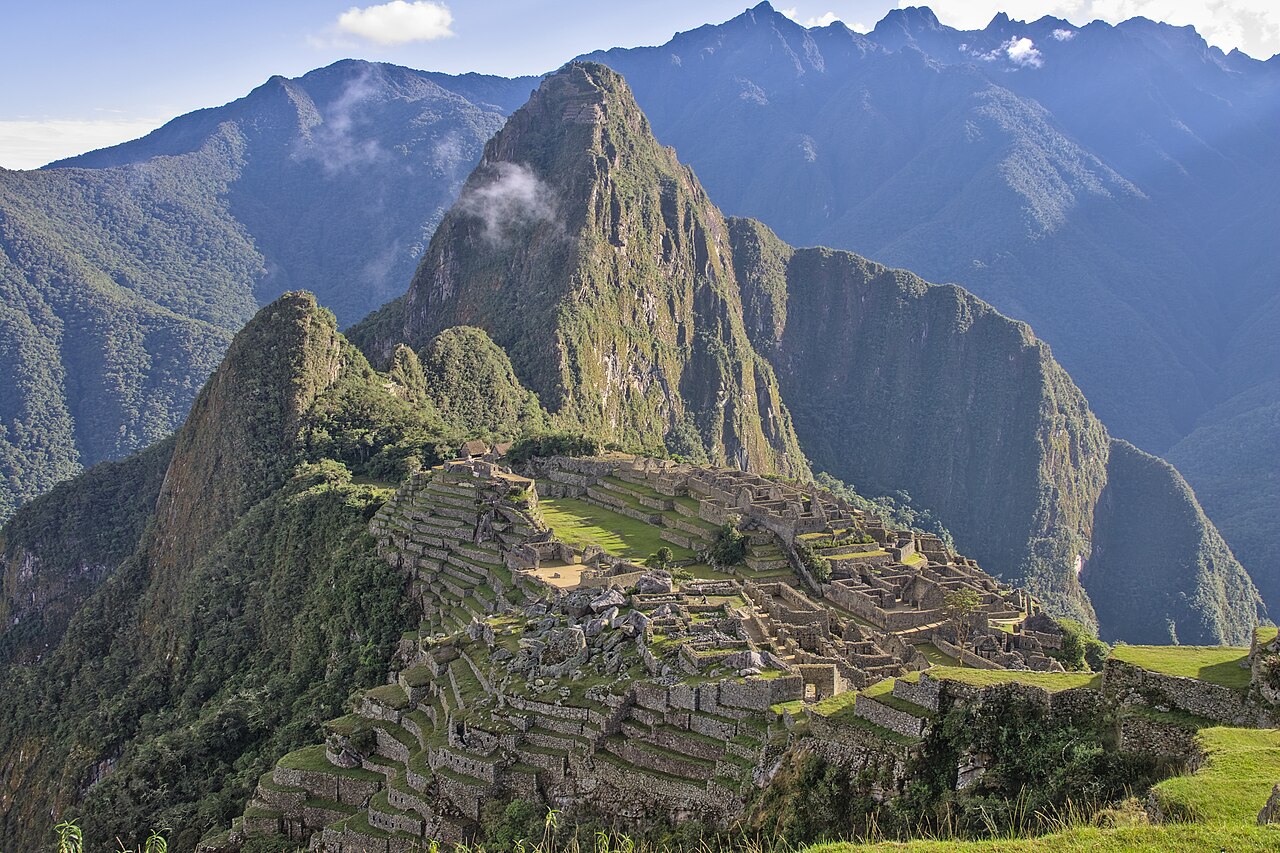
When Hiram Bingham reached Machu Picchu on July 24, 1911, he wasn’t alone, and he wasn’t first. A local farmer and innkeeper, Melchor Arteaga, had led him up the mountain, and at the top, farmers named Richarte and Álvarez were already living on the site and working its ancient terraces. A local boy guided Bingham the last stretch to the ruins.
The citadel was built around 1450, probably as a royal estate for the Inca emperor Pachacuti, and abandoned roughly a century later amid the upheaval of the Spanish conquest. The Spanish apparently never found it, one reason its stonework, fitted so tightly that the joints barely admit a knife blade, survives so well. Even its name may be a modern mix-up. A 2021 study argued the Inca likely called the site Huayna Picchu, or simply Picchu.
Bingham’s photos in National Geographic in 1913 made it world-famous, although an earlier visitor, Agustín Lizárraga, had already written his name and the year 1902 on a temple wall in charcoal. Yale also took thousands of artifacts, returning them only between 2011 and 2012 after a long dispute. Today visits run on timed tickets and fixed circuits, with daily caps of 4,500 visitors, rising to 5,600 in high season under the 2026 rules. Book months ahead.
Lost, Found, and Never Really Gone
The pattern repeats across continents. Cities fall to war, drought, disease, or shifting trade, and the forest, the sand, or the ash moves in. Outsiders forget, mapmakers move on, and centuries later somebody arrives with a notebook and calls it a discovery, often guided by people whose families never left. The rediscovery is real, but it’s rarely the whole story.
If the ancient world keeps pulling you in, explore ancient mysteries scientists still can’t fully explain, or chase the gold that’s still out there with legendary lost treasures waiting to be found.
Quick answers
Who really discovered Machu Picchu?
Hiram Bingham is credited with bringing Machu Picchu to international attention in 1911, but he didn’t discover it. A local farmer guided him there, families were already farming its terraces, and a visitor named Agustín Lizárraga had written his name on a wall in 1902. Bingham’s real contribution was publicizing the site and starting its scientific study.
Why do ancient cities get abandoned and lost?
Usually it’s a combination of pressures rather than one dramatic event. Shifting rivers, drought, earthquakes, war, disease, and changing trade routes can drain a city of people and wealth over generations. Once abandoned, ruins get buried by vegetation, sand, or volcanic ash, and outside powers forget them, even when nearby communities still remember the site.
Are there still undiscovered lost cities?
Almost certainly. Airborne laser scanning, or LiDAR, can see through forest canopy, and recent surveys have revealed huge networks of ancient settlements in places like northern Guatemala and Ecuador’s Upano Valley. Many sites are known to local communities but still unmapped by archaeologists, so the age of rediscovery is very much ongoing, just with better technology.
Sources, further reading & photo credits
- Huayna Picchu — Wikipedia
- Hattusa — Wikipedia
- Ciudad Perdida — Wikipedia
- Mohenjo-daro — Wikipedia
- Great Zimbabwe — Wikipedia
- Tikal — Wikipedia
- Troy — Wikipedia
- Angkor Wat — Wikipedia
- Petra — Wikipedia
- Pompeii — Wikipedia
- Machu Picchu — Wikipedia
Cover image: Martin St-Amant ( S23678 ) · CC BY-SA 3.0 · via Wikimedia Commons. Photos throughout this list are sourced from Wikimedia Commons under the licenses noted in each caption.