10 Natural Wonders That Look Like Another Planet

Some corners of Earth look like a sci-fi set designer got carried away. Candy stripes running across a mountainside. A river that turns blood red. Neon-yellow acid pools in a desert that sits below sea level. None of it is CGI, and you won’t need a spacesuit, because all of it is right here on our own planet.
Here are 10 natural wonders that look like another planet, counted down from merely strange to genuinely otherworldly. For each one you’ll find out what paints it, how it formed, and what it actually takes to see it in person, because a few of these places are a lot easier to admire on a screen than to reach.
10Fly Geyser, Nevada
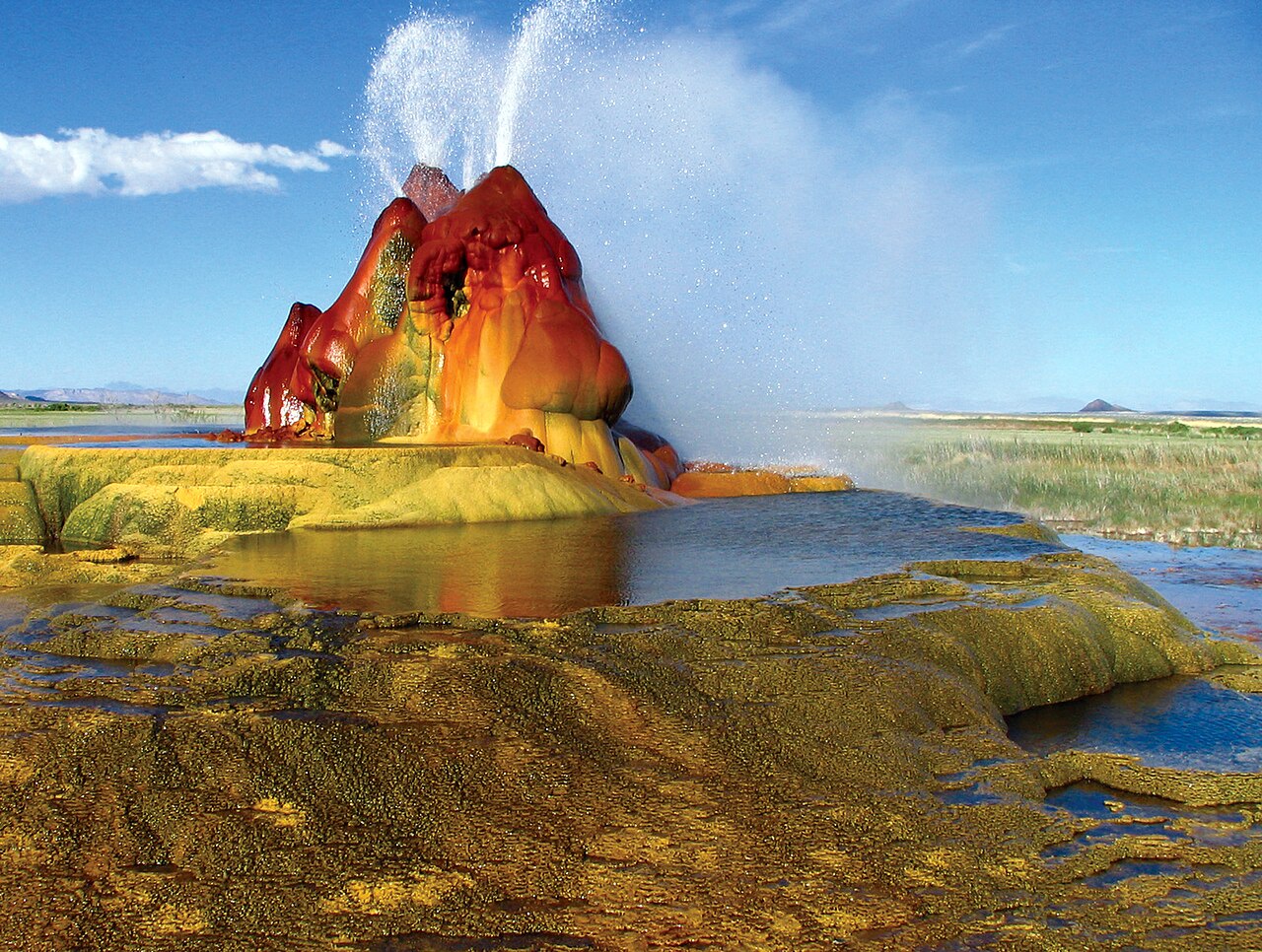
Fly Geyser looks like something a rover would photograph on a distant moon: a cluster of lumpy cones in shades of red, orange, and green, spraying hot water sideways into a ladder of steaming pools in the middle of the Nevada desert. The twist is that people made it, more or less by accident.
In 1916, a well drilled for irrigation water in Hualapai Flat, north of the tiny town of Gerlach, struck near-boiling geothermal water instead and was abandoned. Then in 1964, a geothermal company drilled a second well nearby, and its seal failed. The water found its own way out. Dissolved minerals such as calcium carbonate have been building the mound ever since, while heat-loving microorganisms paint its wet surfaces those wild reds and greens. Water can leave the vents at more than 200°F (93°C).
For decades the geyser sat on private ranch land, glimpsed mostly from the road. In 2016 the nonprofit Burning Man Project bought the surrounding Fly Ranch, roughly 3,800 acres, and now small guided nature walks run from about April to October. Book well ahead, because spots are limited, and don’t plan on wandering in solo. It’s still private property, and the scalding water is no joke.
9Pamukkale, Turkey
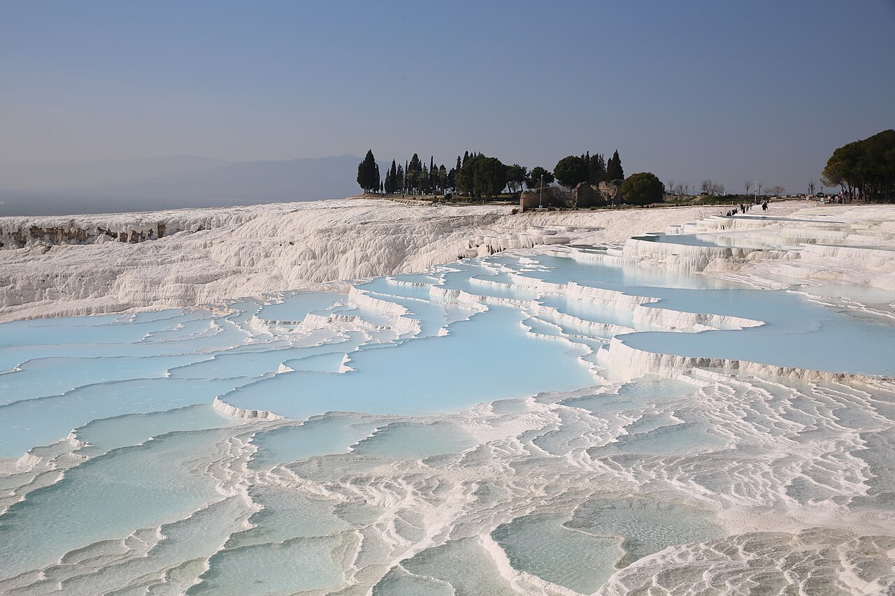
From a distance, the hillside above the Turkish village of Pamukkale looks snow-covered in the middle of summer. Up close, the “snow” turns out to be rock: a staircase of brilliant white terraces brimming with turquoise pools, stretching about 2.7 kilometers along a slope roughly 160 meters high.
The name means “cotton castle” in Turkish, and the chemistry behind it is simple but slow. Hot spring water loaded with calcium carbonate wells up from underground, releases carbon dioxide as it meets the air, and leaves behind a soft mineral gel that hardens into travertine. Layer by layer, over thousands of years, those deposits built shelf after scalloped shelf.
People have been soaking here for a very long time. The spa city of Hierapolis was founded on the plateau above in the 2nd century BC, and today you can swim among toppled marble columns in the so-called Cleopatra’s Pool, though any link to the Egyptian queen is pure legend. Pamukkale and Hierapolis became a joint UNESCO World Heritage Site in 1988. To protect the terraces, visitors walk them barefoot, and some pools are rotated out of use so the travertine can recover. Late afternoon is magic, especially once the tour buses thin out.
8Giant’s Causeway, Northern Ireland
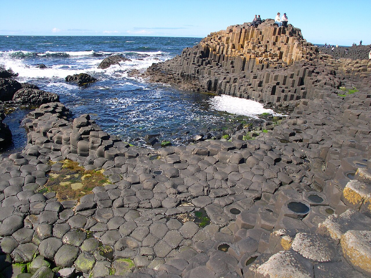
Roughly 40,000 stone columns crowd the shoreline of Northern Ireland’s County Antrim, most of them tidy hexagons fitting together so precisely they look like the work of an obsessive stonemason. They step down into the sea like a giant’s staircase, and the tallest rise about 12 meters.
Legend has it the Irish giant Fionn mac Cumhaill, better known as Finn McCool, built the causeway to reach Scotland and fight his rival Benandonner. In one popular version, Fionn’s wife disguises him as a baby, and the Scottish giant, horrified at the size of the “infant,” flees home and rips up the causeway behind him. Geologists tell a different story. Some 50 to 60 million years ago, lava flooded the area and cooled slowly, contracting and cracking into columns, much the way drying mud splits into polygons.
The scientific world first heard about the site in the 1690s through reports presented to London’s Royal Society, and visitors have been clambering over it ever since. It became a UNESCO World Heritage Site in 1986 and is cared for by the National Trust. Walking down to the stones is free, while the visitor center charges admission. Arrive early or late to dodge crowds, and watch your step, because wet basalt near the waterline is slippery.
7Lençóis Maranhenses, Brazil
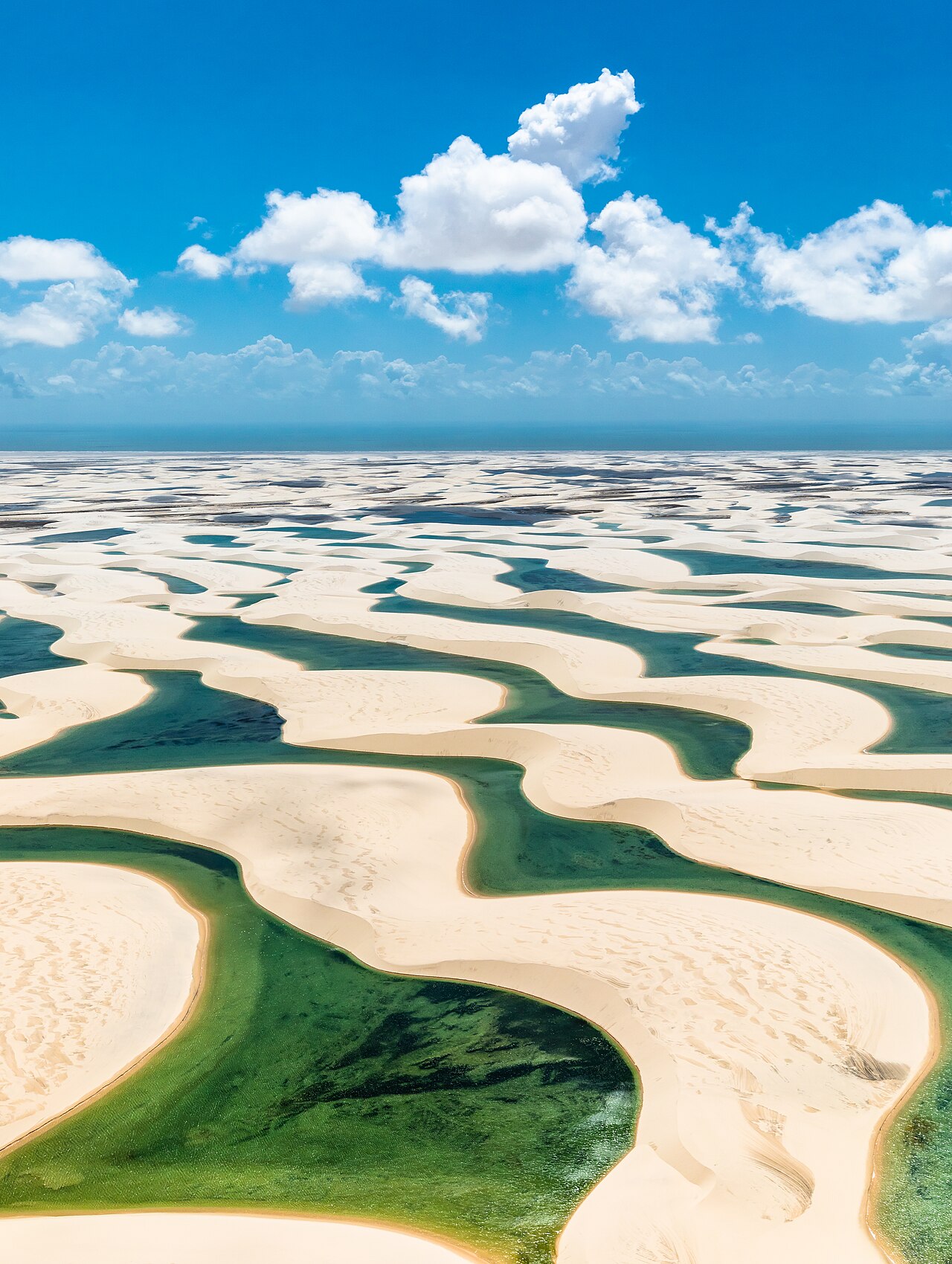
Picture the Sahara, then scatter thousands of turquoise swimming pools between the dunes. That’s Lençóis Maranhenses on Brazil’s northeastern coast, where white sand ridges up to 40 meters high roll inland from the Atlantic and, for part of each year, cradle crystal-clear lagoons of rainwater.
Despite appearances, this isn’t a true desert. The area gets around 1,200 millimeters of rain a year, most of it between January and June. Water pools in the hollows between dunes, and an impermeable layer of rock beneath the sand keeps it from draining away. The lagoons can reach about 3 meters deep, then shrink in the dry season, losing as much as a meter a month to evaporation. Somehow, fish turn up again every year. Wolf fish ride out the dry months buried dormant in wet mud, waiting for the rains to return.
The area became a national park in 1981 and joined UNESCO’s World Heritage list in 2024. The lagoons are usually at their fullest from around June to September, which makes that the classic window to visit. Most travelers base themselves in the town of Barreirinhas, ride into the dunes on 4×4 tours, and then walk across the sand to swim.
6Wulingyuan’s Sandstone Pillars, China
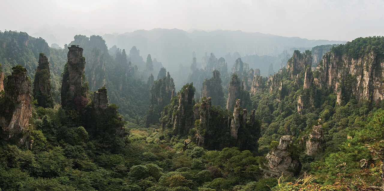
In Wulingyuan, the mountains don’t rise so much as stand at attention. More than 3,000 slender pillars of quartzite sandstone shoot up from the forest in China’s Hunan Province, many of them taller than 200 meters, their tops crowned with pines and often wrapped in drifting mist.
Their shapes come down to water and patience. Over immense spans of time, rain, frost, and plant roots worked into vertical cracks in thick beds of sandstone, widening them into gorges and leaving freestanding towers behind. Zhangjiajie National Forest Park, at the heart of the area, was established in 1982 as China’s first national forest park, and the wider Wulingyuan Scenic Area became a UNESCO World Heritage Site in 1992.
Then Hollywood made it famous all over again. The floating mountains of Pandora in James Cameron’s 2009 film Avatar are widely linked to these peaks, and in 2010 local officials renamed one pillar, the Southern Sky Column, “Avatar Hallelujah Mountain.” Getting around means a mix of trails, park buses, cable cars, and the Bailong Elevator, a glass lift bolted to a cliff that climbs 326 meters. Go early to beat the crowds, bring good shoes for the endless stairs, and hope for mist.
5Vinicunca (Rainbow Mountain), Peru
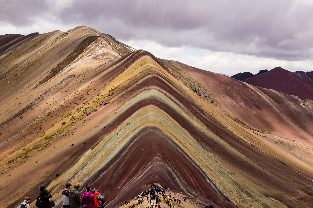
Vinicunca looks like someone took a paint roller to a mountain. Bands of rust red, mustard yellow, lavender, sage green, and cream run across its slopes high in the Peruvian Andes, which is why most of the world knows it simply as Rainbow Mountain.
The stripes are layers of sediment laid down over millions of years, then tilted and exposed by tectonic forces and erosion. Each color has its own mineral recipe: reds from iron-rich clays, yellows from sulfur-bearing sandstones, greens from clays rich in iron and magnesium, and whites from quartz and calcium carbonate. For a long time the summit was capped with ice; local accounts say the glacier melted away around 2013, and photos of the exposed stripes soon spread online. By the mid-2010s, crowds were arriving every day.
The fame brought growing pains. A mining concession granted in 2018 caused a public outcry and was renounced within months, and in 2019 the area was folded into the new Ausangate Regional Conservation Area. A visit usually means a pre-dawn drive from Cusco and a hike of about 5 kilometers to a viewpoint around 5,000 meters up. Spend a few days acclimatizing first; it’s the altitude, not the distance, that flattens most hikers.
4Caño Cristales, Colombia
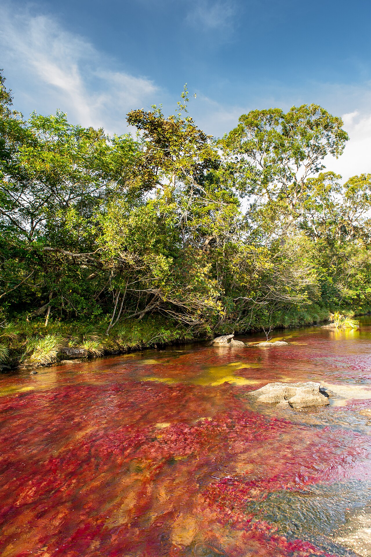
For a few months each year, a river in central Colombia looks as if it’s bleeding. Caño Cristales, nicknamed the “River of Five Colors” and the “Liquid Rainbow,” runs over a bed streaked with crimson and magenta, set off by yellow sand, green moss, black rock, and water so clear it almost disappears.
The star of the show is an aquatic plant, long known as Macarenia clavigera and now often classified as Rhyncholacis clavigera, which clings to the rocks of the riverbed. It starts out green and, when water levels and sunlight are just right, shifts through yellow into vivid shades of red. That usually happens from around late June or July through November. Too much water drowns the color, and too little dries the plants out, so timing a visit is half the adventure.
The river lies in the Serranía de la Macarena, an isolated mountain range where Andean, Amazonian, and Orinoco ecosystems meet. For years, Colombia’s armed conflict kept most outsiders away. Today most visitors fly into the small town of La Macarena and explore with mandatory local guides. The rules are strict: no sunscreen or insect repellent where you’ll swim, and swimming only in designated spots, all to protect the delicate plants.
3Socotra’s Dragon’s Blood Trees, Yemen
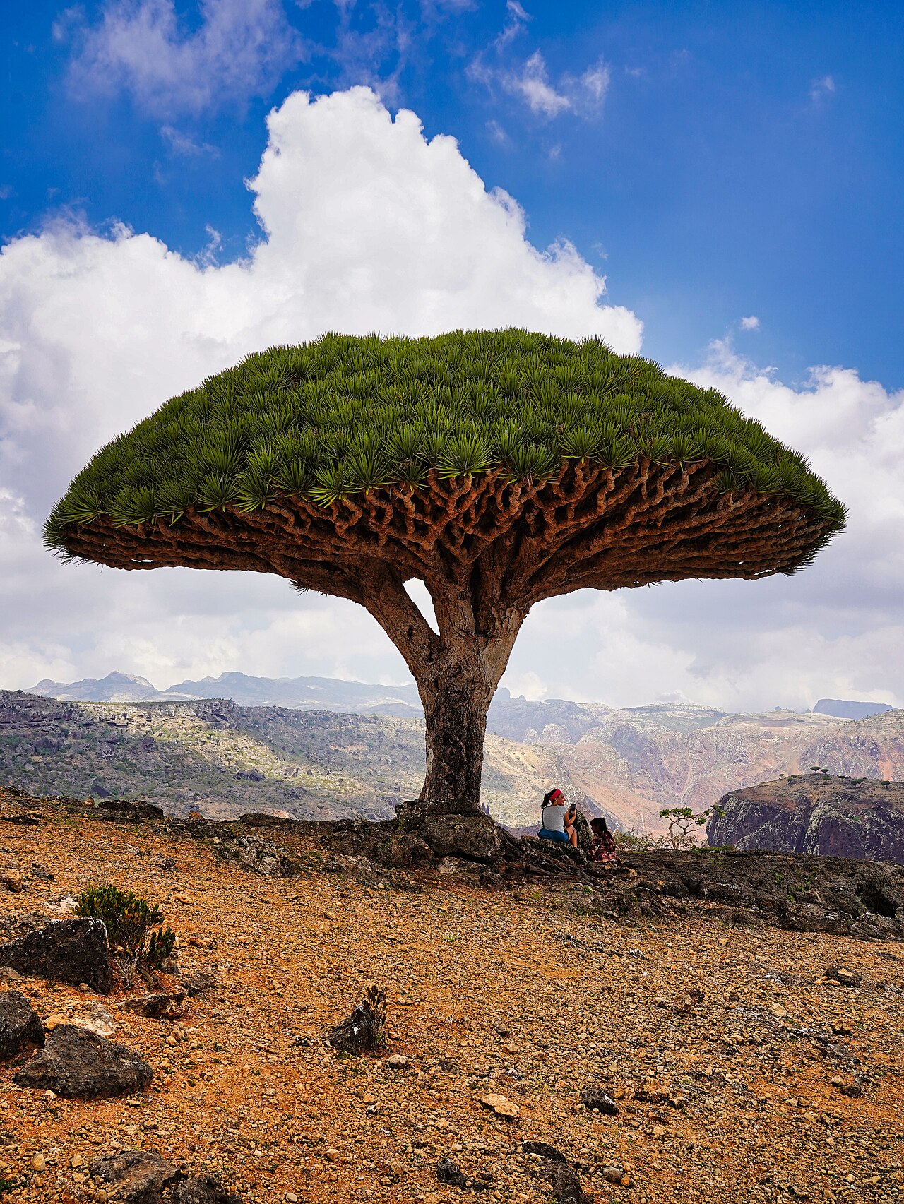
On Socotra’s high plateaus, the trees look like umbrellas blown inside out by a gale. Dragon’s blood trees, Dracaena cinnabari, grow up to about 9 meters tall, with dense crowns held up by branches that all point skyward, a shape that helps them catch moisture from passing mist and shade the ground around their roots.
Socotra, a remote island in the Arabian Sea off the Horn of Africa, has been isolated for millions of years, and evolution there took some creative liberties. According to UNESCO, about 37 percent of its plant species and roughly 90 percent of its reptile species are found nowhere else on Earth. Bulbous desert roses and swollen-trunked cucumber trees complete the alien look. The archipelago became a UNESCO World Heritage Site in 2008.
The trees take their name from their deep red resin, harvested and traded for centuries. Visiting Socotra takes planning. The island belongs to Yemen, and most Western governments advise against all travel to the country, so the small number of tourists who go typically book with specialist operators who arrange visas and seats on the limited flights. Schedules change often, and the windy monsoon season, roughly June to September, can halt tourism altogether.
2Dallol, Ethiopia
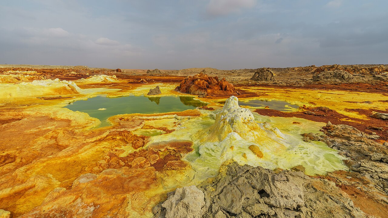
If any place on Earth could pass for an alien moon, it’s Dallol. In the Danakil Depression of northeastern Ethiopia, hot springs bubble up through thick salt beds and paint the ground acid yellow, lime green, rust orange, and chalky white, around pools that can be more acidic than battery acid.
The colors come mostly from iron compounds, sulfur, and salts reacting as hot, mineral-laden water reaches the surface, and the palette keeps changing as pools age and their iron oxidizes to dull browns. It all sits below sea level in a basin that drops more than 100 meters beneath the sea in places, a spot where the African continent is slowly being pulled apart. From 1960 to 1966, a now-abandoned mining settlement here recorded an average annual temperature of about 34.4°C (94°F), still cited as a record for an inhabited place.
Dallol isn’t entirely empty, either. Afar miners still cut salt slabs from the flats nearby, and camel caravans have carried that salt toward the highlands for generations. Visiting means joining an organized tour, often from Mekelle or Semera, with Afar guides and frequently armed escorts because of the region’s proximity to the Eritrean border. Trips usually run in the cooler months, roughly November to February. Always check current government travel advisories before you plan.
1Salar de Uyuni, Bolivia
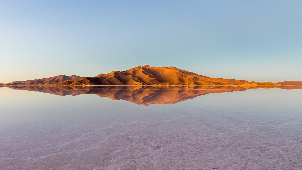
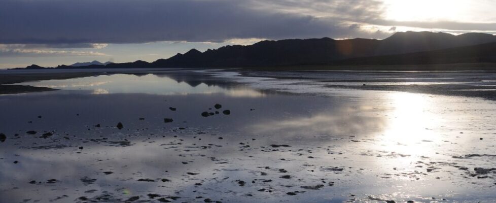
After a rain, the world’s largest salt flat becomes the world’s largest mirror. A thin film of water settles over the Salar de Uyuni in Bolivia’s high Altiplano and reflects the sky so perfectly that the horizon vanishes, and jeeps seem to drive straight through the clouds.
The salar covers roughly 10,582 square kilometers at an elevation of about 3,656 meters, the leftovers of prehistoric lakes that evaporated and left behind an estimated 10 billion tonnes of salt. It is astonishingly flat, with elevation varying by less than a meter across the entire surface, which is why it’s used to calibrate Earth-observing satellites. Beneath the crust lies a brine holding most of Bolivia’s lithium, part of one of the largest known lithium resources on the planet.
In the dry season, the surface cracks into a vast honeycomb of white hexagons. Out in the middle rises Incahuasi Island, a rocky outcrop bristling with giant cacti, and around the edges you’ll find hotels built from salt blocks. Most visitors join multi-day 4×4 tours from the town of Uyuni. For mirror photos, aim for the rainy season, roughly December to April; for the hexagons, come in the dry months. Pack sunglasses and sunscreen, because the glare at that altitude is ferocious.
No Spacesuit Required
Strip away the alien vibes and every place on this list runs on familiar ingredients: water, minerals, heat, wind, a stubborn plant or two, and an enormous amount of time. That’s the real wonder. You don’t need a rocket to visit another world, just good timing, a sturdy pair of shoes, and the patience to respect rules that keep these fragile landscapes intact.
Craving more of Earth’s weirdest side? See rare natural phenomena most people never see, or swap otherworldly landscapes for otherworldly creatures with deep-sea animals that look like aliens.
Quick answers
When is the best time to see the mirror effect at Salar de Uyuni?
The mirror effect appears in the rainy season, roughly December to April, when a thin layer of water covers parts of the salt flat. January through March is often the most reliable stretch. The trade-off is that flooding can block access to spots like Incahuasi Island, so many travelers book tours that adjust their route to conditions.
Why is Rainbow Mountain in Peru so colorful?
Vinicunca’s stripes are layers of sediment deposited over millions of years, later tilted and exposed by tectonic forces and erosion. Different minerals create each band: iron-rich clays make reds, sulfur-bearing sandstones make yellows, iron- and magnesium-rich clays make greens, and quartz and calcium carbonate make whites. Its long-time ice cap reportedly melted around 2013, revealing the colors.
Can you visit Fly Geyser in Nevada?
Yes, but only on an organized visit. Fly Geyser sits on Fly Ranch, private land owned by the nonprofit Burning Man Project since 2016. Small guided nature walks typically run from about April to October and sell out, so book early. Visitors can’t simply drive up and walk in, and the water near the vents is scalding.
Sources, further reading & photo credits
- Salar de Uyuni — Wikipedia
- Fly Geyser — Wikipedia
- Pamukkale — Wikipedia
- Giant’s Causeway — Wikipedia
- Lençóis Maranhenses National Park — Wikipedia
- Wulingyuan — Wikipedia
- Vinicunca — Wikipedia
- Caño Cristales — Wikipedia
- Dracaena cinnabari — Wikipedia
- Dallol (hydrothermal system) — Wikipedia
Cover image: Josep M. Gracia · CC BY-SA 4.0 · via Wikimedia Commons. Photos throughout this list are sourced from Wikimedia Commons under the licenses noted in each caption.