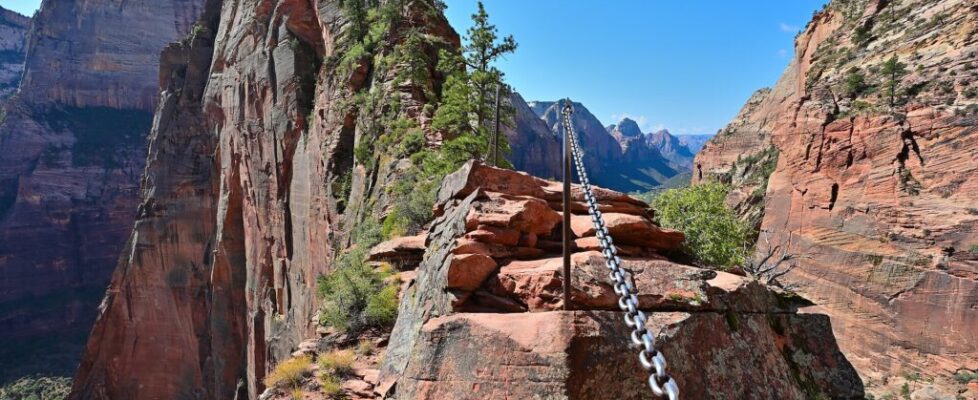
10 of the Most Dangerous Hikes in the World

On China’s Mount Hua, hikers clip a harness to a chain and shuffle sideways along wooden planks bolted to a sheer cliff, with nothing but air beneath their heels and a queue of nervous people waiting behind them. It’s terrifying. It’s also wildly popular, and it’s far from the only trail like it.
This list counts down 10 of the most dangerous hikes in the world, from knife-edge ridges and cliffside boardwalks to summits with weather that has killed experienced mountaineers. With the right preparation, none of them is a death wish, and several now require permits precisely because so many people tried them unprepared. Treat this as a guide to respect, not a dare.
10Longs Peak (Keyhole Route), Colorado
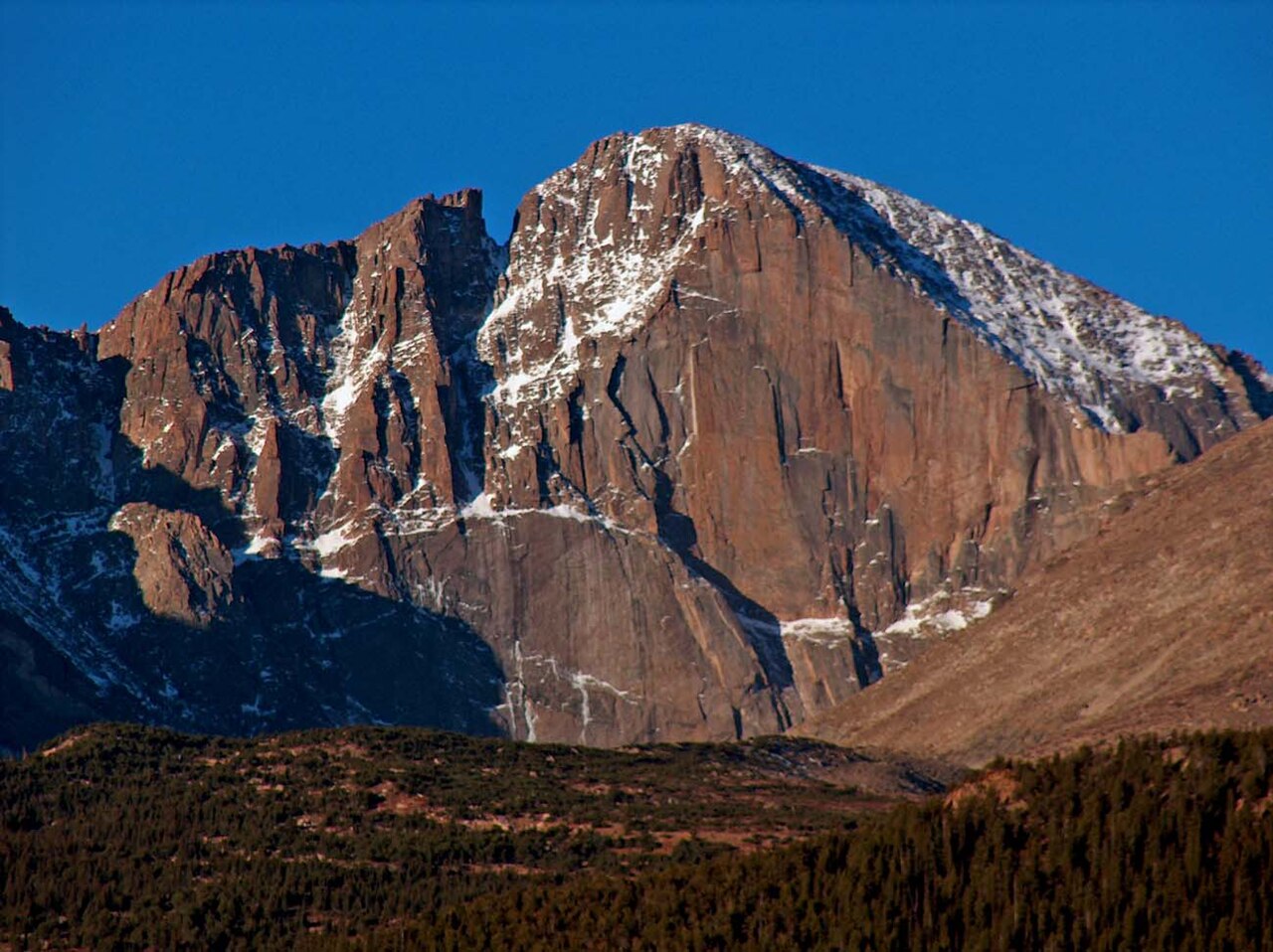
From the plains east of the Rockies, Longs Peak looks like a friendly, flat-topped giant on the horizon. Up close, its most popular route is anything but casual. Beyond a stone notch called the Keyhole, the trail becomes a Class 3 scramble across the Ledges, up a steep gully called the Trough, along the dizzyingly exposed Narrows, and up the Homestretch, a tilted slab of granite leading to the summit.
The numbers are sobering: roughly 15 miles round trip with around 5,000 feet of elevation gain, topping out above 14,000 feet. Dozens of people have died on Longs Peak over the years, from falls, exposure, and lightning, and rescues on the Keyhole Route are a regular occurrence. Afternoon thunderstorms are the classic summer hazard, which is why most hikers start in the dark, often in the small hours of the morning, aiming to summit and get back below tree line before storms build.
The route is generally treated as non-technical only from about mid-July to early September, when it’s mostly free of snow and ice. Outside that window it can demand ice axes and real mountaineering skills. Check the park’s current conditions, carry layers and plenty of water, and treat your turnaround time as non-negotiable. Reaching the Keyhole and heading back down is still a spectacular day out.
9Trolltunga, Norway
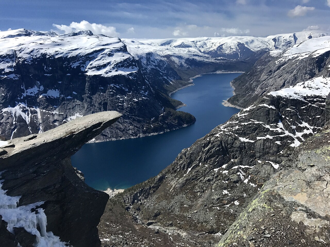
Trolltunga, the “Troll’s Tongue,” is a slab of rock that juts straight out of a cliff about 700 meters above the lake Ringedalsvatnet in western Norway. Stand on the tip and you’ve got one of the most famous photo ops in Europe. Getting there is the hard part.
From the main trailhead at Skjeggedal, the round trip runs roughly 27 kilometers, with around 800 meters of climbing, and typically takes 10 to 12 hours. A higher trailhead at Mågelitopp shaves a few kilometers off, but its small parking lot has to be booked well ahead. The real danger isn’t so much the famous ledge as the long, exposed day. Hikers who start late, underestimate the distance, or set out in sneakers and cotton can be caught far from the road by darkness, fog, rain, or snow, and Norwegian rescuers have repeatedly been called out to help exhausted or lost walkers.
Hiking without a guide is generally considered reasonable only from about mid-June to mid-September, depending on snow. Outside that window, the trail can be buried and its markers hidden, and the standard advice is to go only with a professional mountain guide. Start early, pack a headlamp, extra layers, food, and water, and keep a respectful distance from the edge while you wait your turn for the photo.
8Kalalau Trail, Hawaii
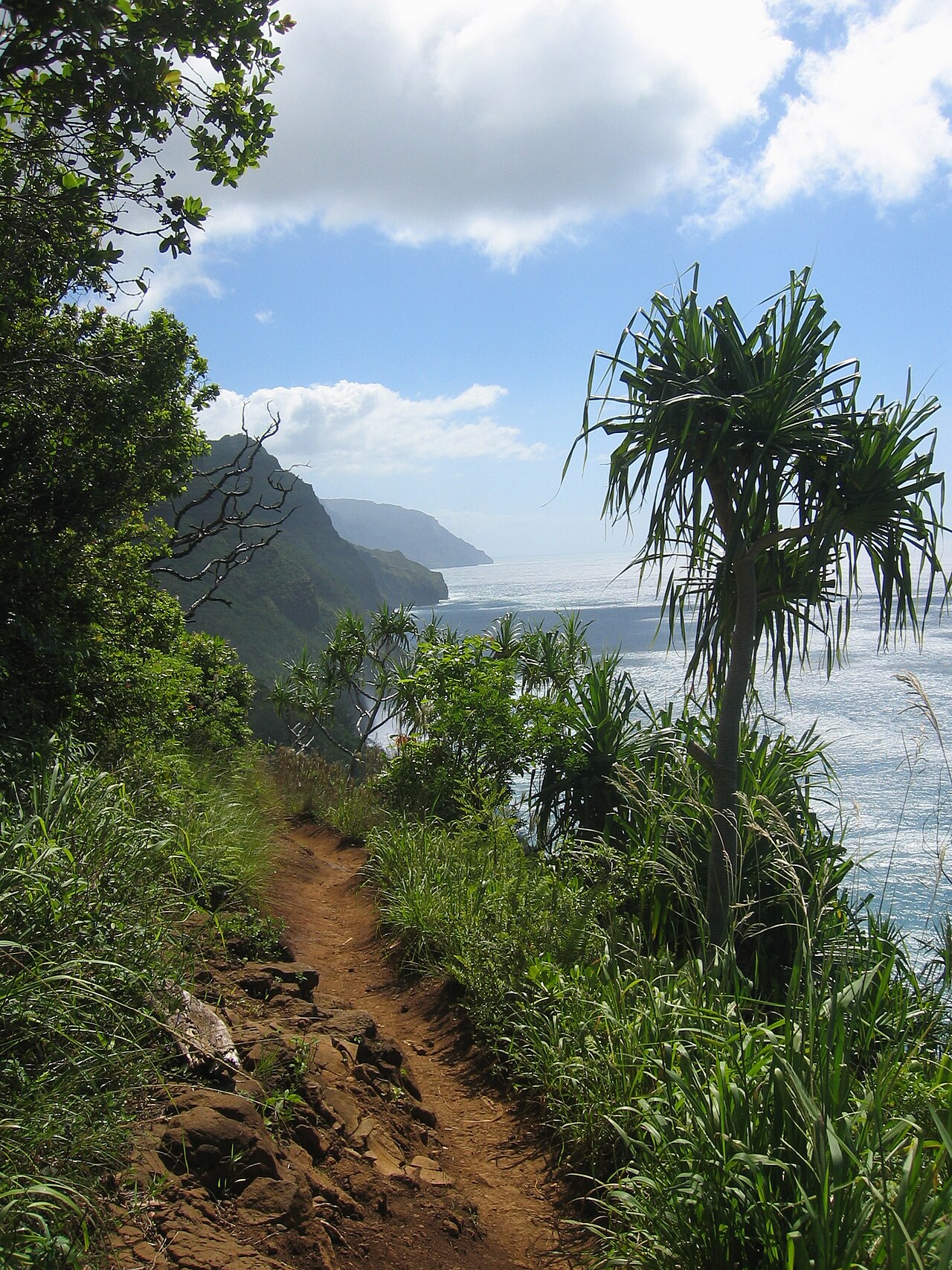
The Kalalau Trail looks like paradise, and in many ways it is. Hugging Kauaʻi’s Nā Pali Coast, it threads 11 miles along emerald cliffs that plunge into the Pacific, crossing lush valleys and streams on the way to a remote beach with no road access. It’s also one of the most treacherous coastal hikes in the United States.
The hazards stack up. Streams can rise in minutes when heavy rain falls upstream, turning easy crossings into deadly flash floods, and hikers are told to wait them out rather than wade in. The trail is often muddy and slick, and some narrow stretches sit above long drops, including an exposed section nicknamed Crawler’s Ledge. Then there’s Hanakāpīʻai Beach, about two miles in, where powerful, unpredictable currents have caused many drownings over the years. Swimming there is strongly discouraged.
Access is tightly controlled. Day hikers need an advance entry or parking reservation for Hāʻena State Park, and anyone continuing beyond Hanakāpīʻai Valley must hold an overnight camping permit. Those permits depend on conditions, and as of October 2026, Hawaii State Parks listed all camping on Kauaʻi as closed until further notice. Check the official park notices before planning, and never try to cross a rising stream.
7Huayna Picchu, Peru
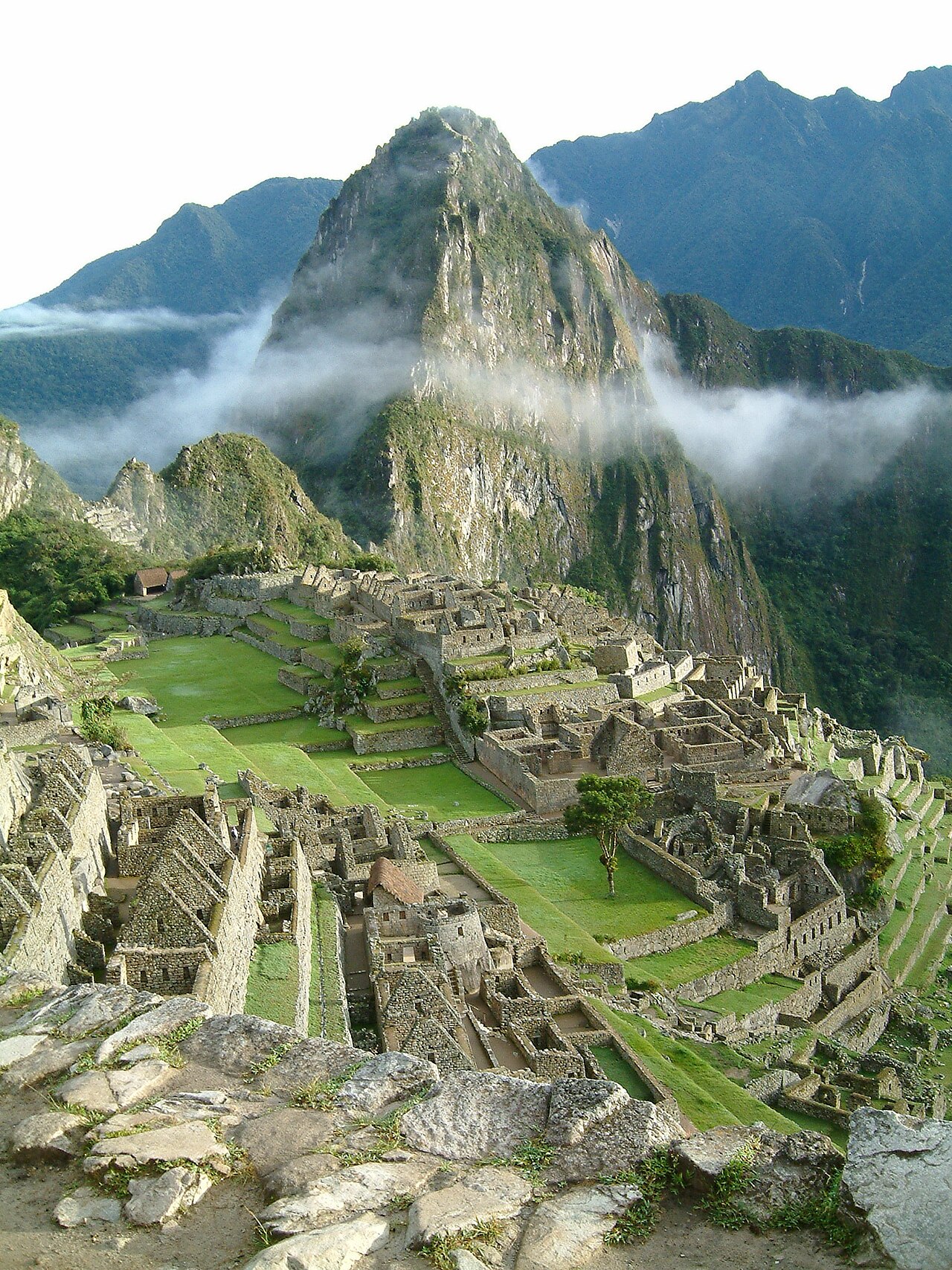
In almost every classic photo of Machu Picchu, the steep green peak looming behind the ruins is Huayna Picchu. It rises roughly 260 meters above the citadel, and yes, there’s a trail to the top, built by the Inca themselves.
The climb is short, around an hour up for most fit hikers, but relentlessly steep. Narrow stone steps, some barely a boot’s width, zigzag up an almost vertical face, with steel cables bolted in along the most exposed stretches. Near the summit, you squeeze through tight rock passages and scramble across terraces built more than five centuries ago. One sheer, narrow staircase has earned the nickname “Stairs of Death” among hikers, which says plenty about how it feels, even if careful hikers manage it every day.
Because the trail is so narrow, numbers are capped. Huayna Picchu tickets are sold in limited quantities together with Machu Picchu entry, with set entry windows, and in high season they can sell out weeks or months ahead. The stone gets slippery in the rainy season, roughly November to March. Bring water and shoes with real grip, take your time on the descent, and skip it if you have a serious fear of heights or bad knees.
6Half Dome Cables, Yosemite
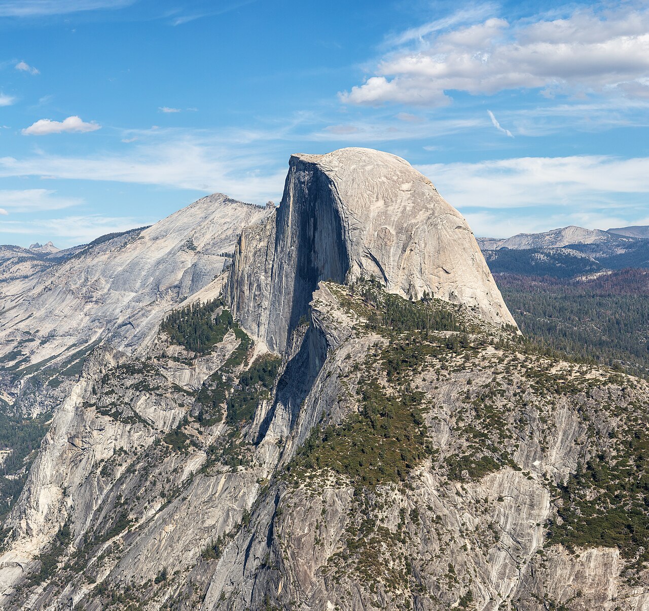
The last 400 feet of the Half Dome hike aren’t really hiking. You grip a pair of steel cables strung up a smooth granite dome so steep it feels like climbing a playground slide in reverse, with wooden crossboards spaced along the way for footholds and a long drop on either side.
That’s the finale of a very long day: roughly 14 to 16 miles round trip with about 4,800 feet of elevation gain, usually via the Mist Trail past Vernal and Nevada Falls. The cables are typically up from late May until mid-October. The biggest dangers are wet rock, crowding, and weather. Wet granite turns alarmingly slick, and the exposed summit is a terrible place to be in a thunderstorm; in 1985, a lightning strike on top killed two people. The rangers’ advice is simple. If clouds are building, turn around.
To manage crowds, Yosemite requires a permit to go beyond the base of the subdome whenever the cables are up. Up to 300 people a day are allowed, most through a preseason lottery in March, with extra permits released in a daily lottery two days ahead. Bring gloves with good grip, start before dawn, and carry plenty of water for the relentless climb out of the valley.
5Aonach Eagach Ridge, Scotland
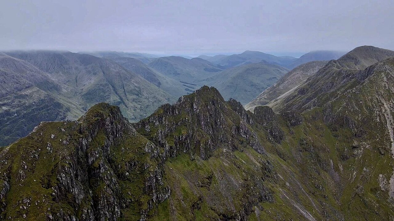
Hillwalkers often describe the Aonach Eagach as the narrowest ridge on the British mainland, and once you’re on it, you won’t want to argue. The jagged crest runs along the north side of Glen Coe in the Scottish Highlands, a rocky spine of teetering pinnacles with steep drops on both sides and the A82 road far below.
The traverse links two Munros, Meall Dearg and Sgùrr nam Fiannaidh, both over 3,000 feet. In summer it’s a grade 2 scramble, meaning hands-on climbing over rock with serious exposure, and in winter it becomes a proper mountaineering route that calls for ropes and ice axes. The real catch is commitment. Once you’re on the crest, there are no safe ways down the south side, so turning back or pushing on are the only sensible options. Walkers and climbers have died here over the years, many in falls into Clachaig Gully near the western end.
This is not a ridge for first-time scramblers. Go in settled, dry weather with a full day ahead of you, a map and compass, and the skills to read the route, or book one of the guided traverses offered by local mountain guides. Sort out transport too, since the traverse usually runs east to west and finishes miles from where it starts.
4Mount Washington, New Hampshire
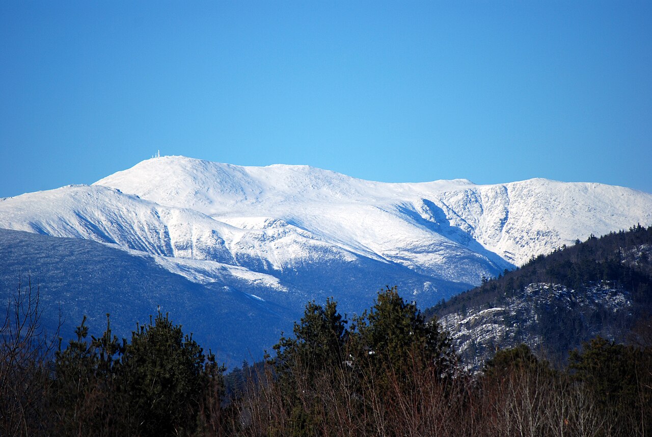
At 6,288 feet, Mount Washington looks almost modest next to the giants of the American West. Don’t be fooled. On April 12, 1934, observers at its summit weather station measured a gust of 231 miles per hour, a record that stood as the fastest surface wind ever measured for more than 60 years.
The mountain sits where major storm tracks converge, and its summit rises above the tree line into a harsh subarctic zone. Conditions can flip from pleasant to life-threatening within hours, with fog, freezing rain, snow, and hurricane-force winds possible even in summer. By most tallies, more than 160 people have died in the Presidential Range since record-keeping began in 1849, from hypothermia, falls, avalanches, and drownings. One of the earliest was Lizzie Bourne, who died near the summit in 1855; a memorial marks the spot.
The irony is that you can drive to the top on the Mount Washington Auto Road or ride the Cog Railway, both running seasonally since the 1800s. Hikers, though, should check the Mount Washington Observatory’s higher-summits forecast before setting out, carry winter-weight layers even in July, and be ready to turn back. Tuckerman Ravine is the classic route, but in winter and spring its avalanche terrain is for experienced mountaineers only.
3Angels Landing, Utah
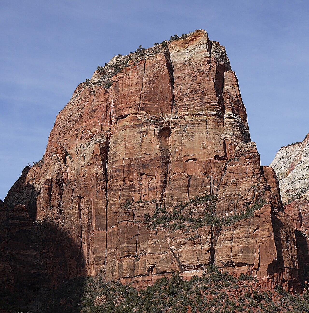
The final half mile to Angels Landing in Zion National Park follows a sandstone fin so narrow that in places it’s just a few feet wide, with drops of many hundreds of feet on either side. Hikers haul themselves up with heavy chains bolted into the rock, often while people coming the other way squeeze past.
The full hike is 5.4 miles round trip with about 1,488 feet of elevation gain. It starts at the Grotto shuttle stop and climbs through Walter’s Wiggles, a famous stack of 21 tight switchbacks, to Scout Lookout, where the chains begin. The trail was built in 1926, and the story goes that the formation got its name a decade earlier, when a visiting minister remarked that only an angel could land on it. Over the years, a number of people have died in falls from the route, and crowding on the chains once made the risks worse.
Since April 2022, every hiker continuing past Scout Lookout onto the chained section has needed a permit, issued through a seasonal lottery and a day-before lottery. The hike to Scout Lookout itself doesn’t require one and still delivers knockout views of Zion Canyon. If you do go up, avoid the chains in wet, icy, or windy conditions, keep three points of contact, and be patient on the busiest sections.
2Caminito del Rey, Spain
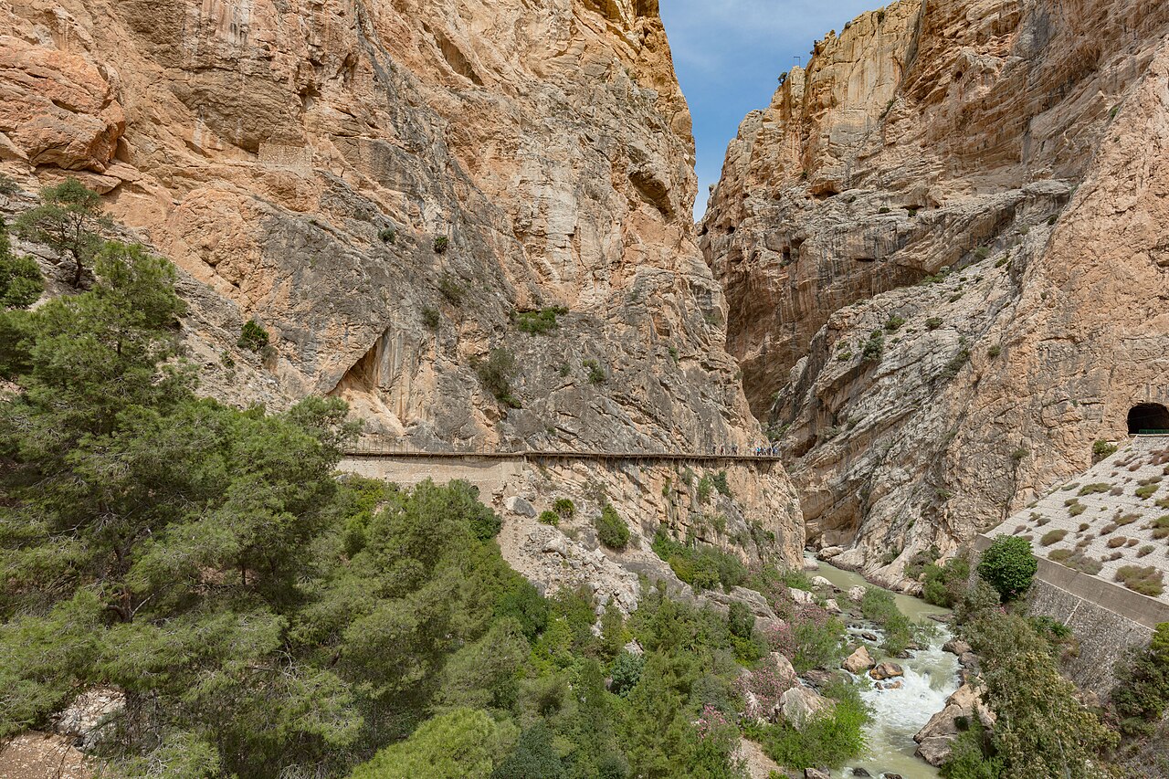
For years, the Caminito del Rey was known as the world’s most dangerous walkway, and the photos explained why: a crumbling concrete ledge about a meter wide, pinned to the walls of a gorge more than 100 meters above the river, with whole sections collapsed into thin air and little but rusted rails and old wires to hold.
The path was built between 1901 and 1905 so workers could move between hydroelectric plants in the El Chorro gorge in southern Spain, haul materials, and maintain a water channel. It earned its royal name, “the King’s Little Path,” after King Alfonso XIII walked it in 1921 to inaugurate a nearby dam. Decades of neglect followed, yet thrill-seekers kept coming. After five people died in 1999 and 2000, the authorities closed both entrances.
In March 2015, after several years of work, the Caminito reopened with a new boardwalk built above the remains of the old one, which you can still see beneath your feet in places. Today it’s a well-managed, genuinely thrilling walk rather than a death trap. Visitors buy timed tickets, wear mandatory helmets, and follow a one-way route that includes roughly 3 kilometers of walkways. Go early, wear sturdy shoes, and skip it if vertigo is a dealbreaker.
1Mount Huashan Plank Walk, China
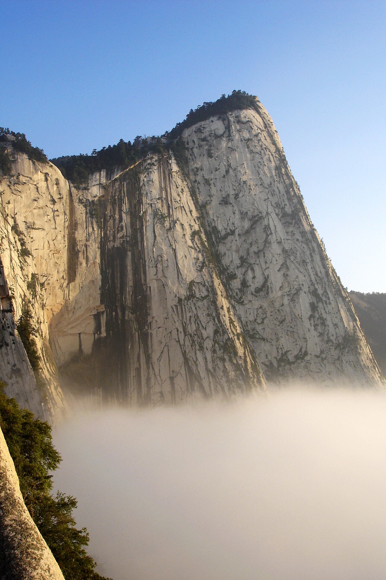
On Mount Hua, the scariest stretch of trail isn’t really a trail. The famous plank walk near the South Peak is a line of wooden boards, in places only about 30 centimeters wide, pinned to a vertical cliff by iron spikes. Hikers inch along it sideways, faces to the rock and harnesses clipped to a chain, with an enormous drop yawning below their heels.
Mount Hua, about 120 kilometers east of Xi’an, is one of China’s five great sacred mountains and has drawn Taoist hermits and pilgrims for many centuries. The plank walk is believed to date back roughly 700 years to the Yuan dynasty, when followers of the Taoist master He Zhizhen built it to reach a remote hermitage high on the cliff. Elsewhere on the mountain, steep stone staircases and the knife-edge Azure Dragon Ridge give hikers plenty more to grip.
Online, Huashan’s danger is often exaggerated. Viral claims of 100 deaths a year have no reliable source, although accidents have happened over the years. Today a safety harness, rented on site, is mandatory on the plank walk, and cable cars serve the North and West peaks, so you can skip much of the climb. Go on a weekday to avoid long queues at the planks, start early, and save it for dry days, never ice or rain.
Know When to Turn Around
What makes a hike dangerous usually isn’t the most photogenic stretch. It’s weather that changes faster than you can descend, fatigue on a trail longer than you planned for, crowds on a narrow ledge, or a stream that rises while you’re on the wrong side. The hikers who come home happy tend to share a habit: they check conditions, carry more than they think they’ll need, and turn back without shame.
If you’d rather admire the planet’s wildest scenery from a safer vantage point, browse natural wonders that look like another planet, or meet the risks that come with fur and fangs in the deadliest animals on Earth.
Quick answers
What is the most dangerous hike in the world?
There’s no official ranking, and danger depends heavily on weather, crowds, and preparation. Mount Hua’s plank walk is often called the scariest because of its exposure, but mandatory harnesses make it safer than it looks. Peaks with harsh weather and long, committing routes, like Longs Peak and Mount Washington, have recorded far more deaths over the decades.
Do you need a permit to hike Angels Landing or Half Dome?
Yes. Angels Landing has required a permit for the chained section beyond Scout Lookout since April 2022, issued through seasonal and day-before lotteries. Half Dome requires a permit to go past the base of the subdome whenever the cables are up, with most permits issued in a March preseason lottery and more in a daily lottery.
How can you stay safe on a dangerous hike?
Check the forecast and official trail conditions, start early, and set a firm turnaround time. Carry water, food, a headlamp, layers, and a way to navigate, and tell someone your plan. Avoid exposed sections in rain, ice, wind, or lightning, and consider a licensed guide for scrambles or unfamiliar terrain. Turning back is always an option.
Sources, further reading & photo credits
- Trolltunga — Wikipedia
- Longs Peak — Wikipedia
- Kalalau Trail — Wikipedia
- Huayna Picchu — Wikipedia
- Half Dome — Wikipedia
- Aonach Eagach — Wikipedia
- Mount Washington — Wikipedia
- Angels Landing — Wikipedia
- Caminito del Rey — Wikipedia
- Mount Hua — Wikipedia
Cover image: Andrew Heneen · CC BY 4.0 · via Wikimedia Commons. Photos throughout this list are sourced from Wikimedia Commons under the licenses noted in each caption.